
Drainage contractor in Fishers, IN
In 1960 Fishers had 388 residents. The 2020 Census counted 99,451. Almost everything built in this town went in during one long boom, on the same slow Hamilton County clay that was here before any of it.
Local conditions
What is under your yard in Fishers
- 388 PEOPLE IN 1960, 99,451 IN 2020 Fishers went from 388 residents in 1960 to 9,941 in 1990, 39,043 in 2000, 76,794 in 2010 and 99,451 in 2020, a 166.6 percent increase since 2000 alone. Biggest US Cities, Fishers population history
- A RAIL STOP FROM 1872 Fishers began when Salathiel Fisher platted his land into town lots along the rail corridor, known as Fishers Switch, across Delaware and Fall Creek Townships in southeastern Hamilton County. City of Fishers, our history
- SR 37 AND I-69 LIT THE FUSE The relocation of SR 37 and its connection to I-69 catalyzed the suburban boom, and development around Geist Reservoir accelerated through the 1980s, right when the town's growth curve turned steep. City of Fishers, our history
- CLAY BETWEEN EVERY TWO ROOFLINES Fishers sits on the same Crosby and Brookston soils as the rest of Hamilton County, 25 to 45 percent clay in the subsoil with a seasonal high water table only 6 to 24 inches down. USDA NRCS Official Series Description, Crosby
- GEIST RESERVOIR: 1,890 ACRES Geist Reservoir holds about 6.1 billion gallons across 1,890 acres, created by damming Fall Creek in 1943 for Indianapolis's water supply. It straddles Fishers, Indianapolis, Lawrence, Fortville and McCordsville. Geist Reservoir
- A RECORD RIVER CREST THIS MONTH The White River crested at 23.96 to 24.6 feet in August 2026, past the 113-year-old record of 23.8 feet from March 1913, after more than 11 inches of rain fell east of Indianapolis. Larry In Fishers, flood emergency coverage
Fishers, specifically
A town built fast, on soil that never sped up
Fishers began in 1872, when Salathiel Fisher platted his land into town lots along the rail corridor, a stop that became known as Fishers Switch, straddling Delaware and Fall Creek Townships in southeastern Hamilton County. For most of the next century it stayed a small rail-line farm town. As late as 1960, Fishers had 388 residents. That is not a typo. Three hundred and eighty-eight people, in a place that now holds close to a hundred thousand.
The growth came in one long acceleration. By 1990 Fishers had 9,941 residents. By 2000 it had 39,043, the fastest-growing decade the town has ever recorded. By 2010 it was 76,794, and the 2020 Census counted 99,451, a 166.6 percent increase since 2000 alone. The relocation of SR 37 and its eventual connection to I-69 catalyzed the boom, and development around Geist Reservoir picked up its own pace through the 1980s. Almost everything that makes Fishers look like Fishers today, the subdivisions, the roads, the schools, went in within the working lifetime of people who still live here.
What did not change is the dirt underneath it. Fishers sits on the same Hamilton County glacial till as the rest of the county, dominated by Crosby soil, somewhat poorly drained with a seasonal high water table only 6 to 24 inches down, and Brookston in the low spots, rated very poorly drained. On a modern subdivision lot, that shows up in a specific and irritating way: two houses built close together, both roofs pouring into the narrow side yard between them, and neither downspout with anywhere real to send the water. Clay carrying 35 to 45 percent in the subsoil will not swallow that volume. It sits, and it finds the lowest crack in one foundation or the other instead of a drain that was never designed in.
Geist Reservoir sits on Fishers' southeast edge, 1,890 acres and roughly 6.1 billion gallons, created by damming Fall Creek in 1943 to supply Indianapolis with drinking water. It straddles Fishers, Indianapolis, Lawrence, Fortville and McCordsville, which is part of why high water on Fall Creek is never just one town's problem.
That became obvious this month. Over 11 inches of rain fell east of Indianapolis, and the National Weather Service called part of the event a 1-in-1,000-year rainfall. The White River crested at 23.96 to 24.6 feet, past the 113-year-old record of 23.8 feet set in March 1913. Mayor Scott Fadness declared a local disaster emergency running through 22 August. The city evacuated residents near Wapahani Drive and the Luxhaven area and closed Florida Road between Geist Ridge and Bowline, along with Trails End Drive and Wapahani Drive itself. White River Park, AgriPark, Geist Waterfront Park, Cumberland Park and Hamilton Proper Park all closed. If your property sits anywhere near that stretch, it is worth having your grading and outlet points checked now, while the ground is still settling, rather than waiting for the next storm to point it out for you.
Fishers runs its own Stormwater Division inside Public Works, managing an MS4 program that covers 17,000 storm sewer pipes and 19,000 storm drains, along with construction-site plan review, BMP maintenance, stream restoration, floodplain permitting and street sweeping across 800 lane miles. Residents with a drainage, sump pump, erosion or floodplain concern can report it directly through Fishers Connect or by calling 317-595-3111. Separately, the Hamilton County Surveyor's Office requires a permit before any work crosses or outlets into a regulated drain easement anywhere in the county, Fishers included, and on a town built out this fast, those easements turn up on more lots than most people expect.
Parts of Fishers we work in
Fishers neighborhoods and landmarks we know well. This is coverage information, not a list of links.
near Geist Reservoir Geist Waterfront Park area Sunblest Farms Windermere Windermere Pointe Avalon of Fishers Britton Falls Sand Creek Estates the Nickel Plate District along the Nickel Plate Trail near Conner Prairie Ritchey Woods Nature Preserve White River Park area AgriPark area Fall Creek corridor near Wapahani Drive Florida Road area
What we install here
Services in Fishers
- Yard Drainage For the side yard between two rooflines
- French Drain Inside the basement, cut in along the wall
- Downspout Drainage Keeps roof water off your neighbor's lot
- Downspout Extension The fastest fix on a tight modern lot
- Trench Drain Hand-dug, rock-covered drains through the yard
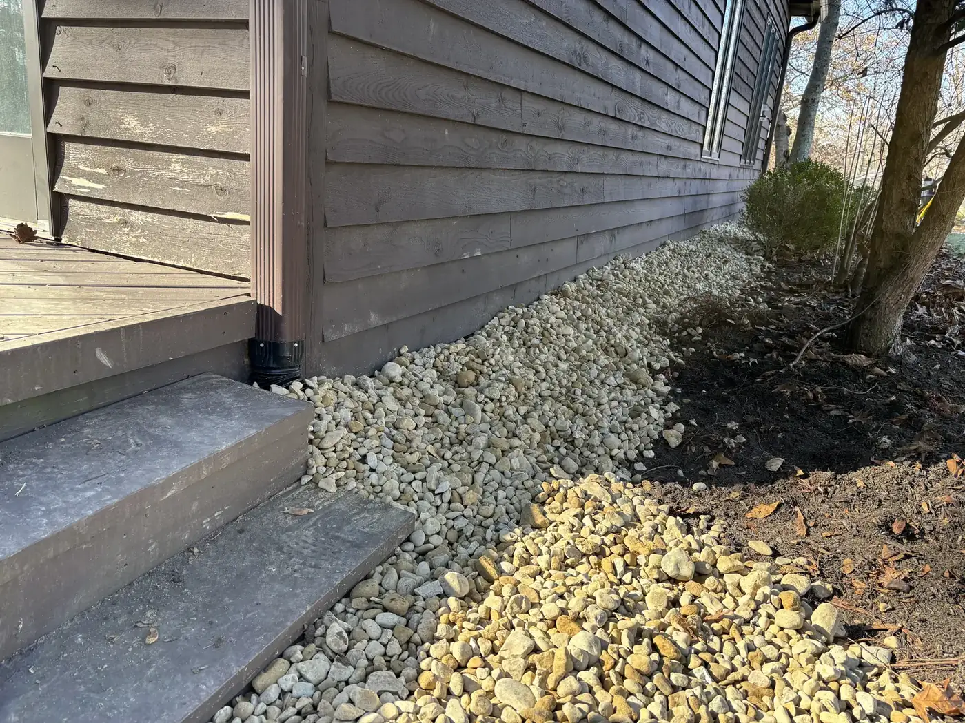
- Foundation Swale A rock-covered trench along the house
- Wet Yard Solutions When two roofs share one narrow yard
- Wet Basement Solutions For newer foundations built during the boom
- Crawlspace Solutions Common in Fishers townhomes and patio homes
- Sump Pump Installation With battery backup for storm season
- Stone Walkway Creation Finish work in the same visit
The Fishers Stormwater Division and county drain permits
Fishers runs its own MS4 program through the Public Works Stormwater Division, covering 17,000 storm sewer pipes and 19,000 storm drains, plus construction-site plan review, BMP maintenance, stream restoration and floodplain permitting. If you have a drainage, sump pump, erosion or floodplain concern, the city wants it reported directly through Fishers Connect or by calling 317-595-3111.
Separately, the Hamilton County Surveyor's Office administers permits for regulated drains countywide, including inside Fishers. Crossing, outletting into, or working within a regulated drain easement without one is a violation subject to enforcement.
We check what applies to your address during the free estimate and tell you before we dig, not after. City of Fishers, Stormwater Division.
Nearby towns we work in
- Noblesville
- McCordsville
- Fortville
- Geist
- Lawrence
- Indianapolis
Reviews from around Indiana
These come straight from our Google Business Profile, including the reviewer's own town.
Fishers questions
What Hamilton County homeowners ask
On a lot of modern Fishers subdivisions, two houses sit close enough that both roofs shed into that same strip of ground. Crosby clay, the dominant soil in Hamilton County, runs 35 to 45 percent clay in the subsoil and holds a seasonal high water table only 6 to 24 inches down in winter and spring, so it cannot absorb two rooflines' worth of runoff on its own.
We route that water in a rock-filled strip with a real outlet, rather than letting it sit against two foundations at once.
The White River crested at 23.96 to 24.6 feet this month, past the 113-year-old record of 23.8 feet. Fishers evacuated residents near Wapahani Drive and the Luxhaven area and closed Florida Road between Geist Ridge and Bowline, plus Trails End Drive, White River Park, AgriPark, Geist Waterfront Park, Cumberland Park and Hamilton Proper Park. If your property is near any of those, it is worth having your grading and outlet points checked, even without a repeat storm, since ground near a record crest can behave differently for a while afterward.
Depends on where the problem sits. Fishers' Stormwater Division manages the public system, 17,000 storm sewer pipes and 19,000 storm drains, and wants drainage, sump pump, erosion or floodplain concerns reported through Fishers Connect or at 317-595-3111. If the issue is your own yard, downspout or sump line, that is squarely our work, and we will tell you plainly if what you are describing actually needs a city report instead.
Fishers added more than 20,000 residents in the 2000s alone and kept growing fast through 2020, which means a lot of the town's subdivisions were built quickly, one after another, on the same Crosby and Brookston clay. Grading that looked fine at closing can settle unevenly within a decade, especially in the tight side yards common to newer lot layouts, and a downspout system sized for the original plan does not always keep up.
If the work crosses or outlets into a regulated drain easement, yes. The Hamilton County Surveyor's Office administers those permits countywide, including inside Fishers, and unpermitted work in an easement is subject to enforcement. We check for a regulated easement on any lot near Geist Reservoir or Fall Creek before we plan a route.
Where to next?
Free estimate in Fishers
A town built fast needs drainage that was not rushed.
Send the form and we will reply within about 30 minutes during business hours, or call and talk to a person now.
- Free on-site visit anywhere in Fishers and Hamilton County
- Side-yard and downspout lines routed off your neighbor's lot
- Dug by hand, so new subdivision clay does not get compacted further
- Fixed written price before anything starts